Garmin G700 TXi ready

Garmin G700 TXi

Next-Generation Avionics: Touchscreen Precision Meets Versatile Functionality

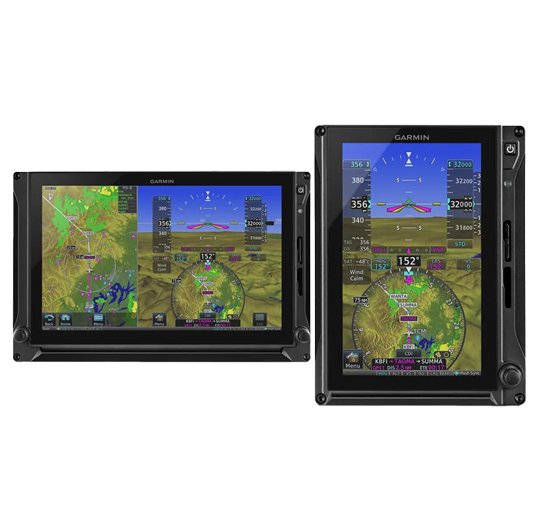
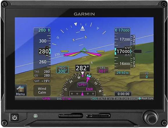
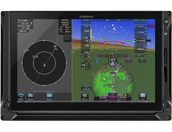
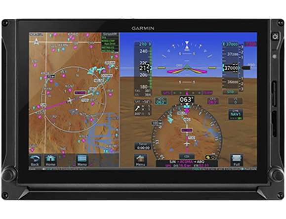
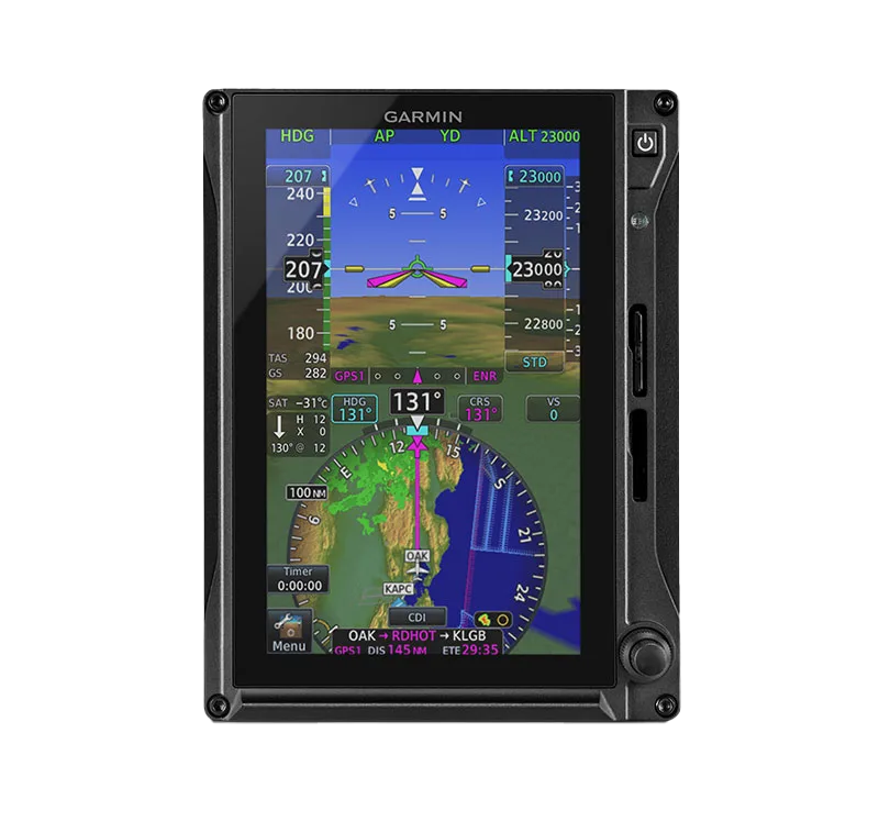
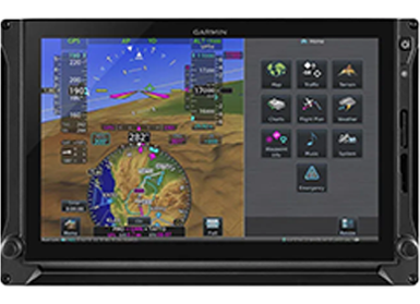
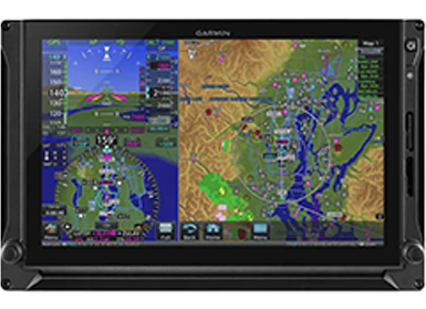
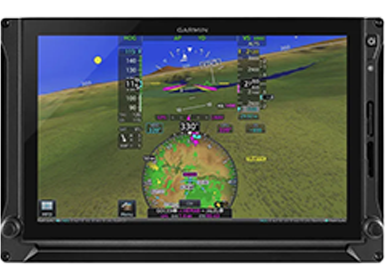
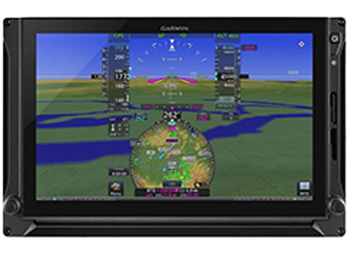
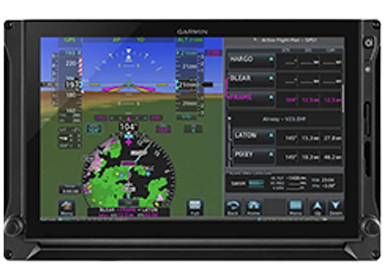
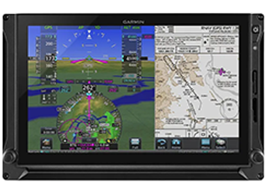
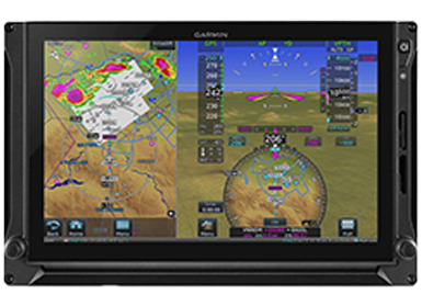
The G700 TXi is an advanced touchscreen avionics system designed for optimal flight performance and safety. It boasts bright 10.6” and 7” LCD displays, enhanced by powerful dual-core processors for quick graphical rendering. With capabilities such as 3D Garmin SVT™ synthetic vision, HSI mapping for increased situational awareness, and compatibility with the GTN™ Xi series for FMS functions, it ensures precision and comprehensive flight data. The system integrates seamlessly with various sensors, datalinks, and features like Connext wireless cockpit connectivity. Offering configurations to suit varied panels and budgets, this system melds modern technology with familiar tactile controls, streamlining cockpit operations and enhancing pilot experience.

INSTALLATION REQUEST

Contact Us

Need Consult? Just Send the Form

GLASS COCKPIT RETROFIT TOUCHSCREEN SOLUTIONS

This scalable LCD touchscreen display offers industry-leading flexibility to accommodate a wide range of configurations in business and commercial aircraft.

Aircraft pictogram ready

Meets level A software assurance levels for Part 23 Class 4 (MTOW more than 12,500 lbs) and Part 25 aircraft.

Displays pictogram ready

Bright, crisp 10.6” and 7” LCD solid-state displays make it easy to upgrade previous-generation avionics.

Certification pictogram

Certifiable for WAAS LPV and Reduced Vertical Separation Minimum operations.

awareness pictogram ready 2

Garmin SVT synthetic vision on the PFD realistically depicts terrain data, obstacles, airports and more in 3D.

Pair Up pictogram

Pairs with GTN Xi series navigators to offer flight management system (FMS) capabilities and options.

HSI Map pictogram ready

HSI mapping puts an MFD-like perspective map view on the PFD to provide even more situational awareness.

A smart avionics upgrade.

Cost Effective Upgrades-2
COST-EFFECTIVE UPGRADES

Compatibility with a wide range of existing avionics systems provides an economical upgrade solution. In some installations, PFD controllers may be available to provide additional control redundancy of PFD settings.

GTN XI Navigator Compat-1
GTN XI NAVIGATOR COMPATIBILITY

The G700 TXi touchscreen display pairs with the GTN Xi series to offer FMS capabilities and options such as TAWS-A terrain alerting, TCAS II traffic resolution advisories1 and descent vertical navigation.

Less Maintenance r
LESS MAINTENANCE

Reliable solid-state attitude heading reference system sensors replace maintenance-prone mechanical gyros for added precision and reduced overall lifecycle costs, improved dispatch reliability and greater weight savings.

portrait or landscape
PORTRAIT OR LANDSCAPE DISPLAYS

Available in 7” portrait or landscape orientations — and in a larger 10.6” horizontal format — the displays offer a variety of configurations to fit your panel and your budget.

The information you need at your fingertips.

INTUITIVE MENU INTERFACE r
INTUITIVE MENU INTERFACE

The TXi series lets you use familiar knobs and/or touchscreen inputs to quickly access the functions, screen views and other flight information you want to see.

faster processing r
FASTER PROCESSING

Powerful dual-core processors boost the system’s graphical display capabilities — with faster zooming, panning and map rendering.

synthetic vision technology r
SYNTHETIC VISION TECHNOLOGY

Garmin SVT enables a 3D virtual reality landscape to be integrated on the TXi flight display.

Upgrade Your Aircraft

Enhance your situational awareness.

hsi mapping r
HSI MAPPING

HSI mapping capabilities offer an MFD-like perspective map view that helps focus pilot scan. This map view can also support the overlay of NEXRAD imagery and weather input from ADS-B and SiriusXM® datalinks, the SafeTaxi® database, active traffic, relative terrain and more.

CONNEXT® COCKPIT CONNECTIVITY r
CONNEXT® COCKPIT CONNECTIVITY

G700 TXi can be teamed with a GTN 750Xi or GTN 650Xi series navigator and your Flight Stream 510 gateway2 to enable Connext wireless cockpit connectivity.

DYNAMIC MAPS AND CHARTS r
DYNAMIC MAPS AND CHARTS

Easily view terrain features, cities, airports, airspace boundaries, navaids, flight plan routings and more. The FliteCharts® database or optional Jeppesen® ChartView version can provide georeferenced approach plates and procedures.

SENSORS AND DATALINKS r
SENSORS AND DATALINKS

The G700 TXi touchscreen display seamlessly integrates with a variety of available sensors and datalinks, including GWX 75, GTX 345, GDL® 69A and GSR 56.