Garmin G900X
Taking Flight to the Next Level with Modern Tech
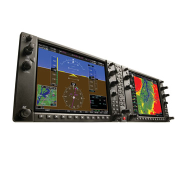
The G900X offers an integrated flight system with dual 10.4" high-definition LCDs, showcasing SVT™ synthetic vision technology for a 3-D visual of the external environment. Designed for easy installation, it comes equipped with a WAAS-certified GPS/Comm, transponder, audio panel, and an array of other features including terrain, traffic, and weather sensors, as well as engine monitoring. With options like XM WX Satellite Weather, terrain alerting, and Garmin SafeTaxi airport diagrams, it provides pilots with comprehensive situational awareness and enhanced navigation for optimal flight safety and efficiency.
Installation Request
Need Consult? Just Send the Form
Contact Us
Need Consult? Just Send the Form

Reduce Workload and Enhance Situational Awareness
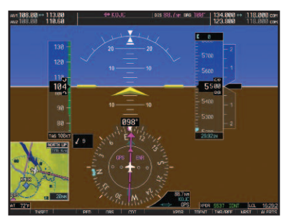
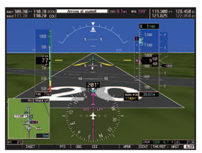
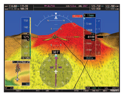
Similar to the G1000, the G900X integrates all primary flight, navigation, communication, terrain, traffic, surveillance, weather and engine sensor data on dual 10.4", high-definition LCDs. These big, easy-to-scan glass displays feature wide viewing angles, brilliant color and direct sunlight readability. SVT™ synthetic vision technology provides a 3-D "virtual reality" display of what lies outside the cockpit.
The dealer-supplied G900X package comes with everything you need for a simple, straightforward installation, from WAAS-certified GPS/Comm with transponder and AHRS sensors to audio panel, wiring harness, drawings, AHRS and magnetometer mounting brackets. Just add the finishing touches, and your glass cockpit is ready to fly.
Integrated Suite of Components
The following G900X system components are available on Lancair and Van’s airframes:
- Dual 10.4" AMLCD displays — interchangeable for use as PFDs or MFDs
- Fully integrated CNI suite with WAAS-certified GPS and digital HSI standard
- SVT synthetic vision technology
- Full reversionary display capability
- Integrated solid state Attitude and Heading Reference System (AHRS)
- Digital air-data computer
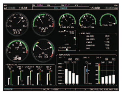
- Engine-monitoring display
- 16-watt VHF comm transceivers with 8.33 kHz channel spacing
- Digital audio panel with auto-squelch and “instant replay” clearance recorder
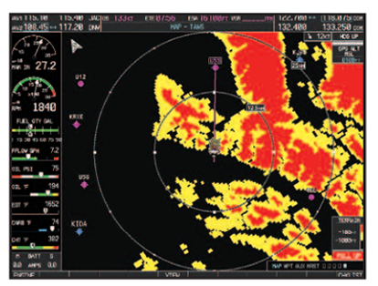
- Interfaces for terrain, traffic and weather sensors
- Mode-S transponder with Traffic Information Service (TIS)
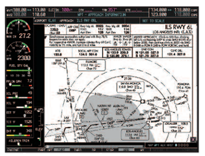
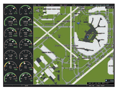
- Built-in SafeTaxi® with either U.S. or Europe airport diagrams
- Built-in Worldwide terrain and U.S. obstacle database
- Built-in AOPA U.S. airport directory data or optional AC-U-KWIK international airport directory data
- Optional integrated Class-B Terrain Awareness and Warning System (TAWS)
- Optional XM WX Satellite Weather and SiriusXM Satellite Radio
- Optional Flight Management System (FMS) controller for simplified data entry
- Supports FliteCharts® electronic charting
- Modular rack-mounted LRUs
- Aircraft-specific mounting brackets for AHRS and magnetometer
- Interface support for most popular kitbuilder autopilots

Dual Screens

Envision the possibilities: Garmin G900X™ foryour kit plane.
And for the ultimate in pilot perspective, Garmin’s amazing SVT synthetic vision technology is now available on the G900X as well. Using terrain-allerting data to synthesize a 3-D "virtual reality" viewscape on the pilot’s primary flight display (PFD), Garmin’s SVT presentation looks so real, it’s almost like having a clear-day, out-the-window view in any weather or flight situation. Garmin G900X: For your next kitplane project, the avionics choice is clear as glass.