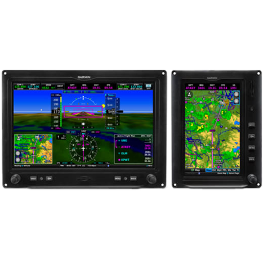
Garmin G3X Touch
The G3X Touch offers a comprehensive flight interface, revolutionizing cockpit efficiency with a high-resolution, versatile LCD display. It seamlessly integrates with various functions such as PFD, MFD, and EIS, and supports portrait or landscape orientations. It enhances navigation with an interactive map, georeferenced terminal procedures, and offers a connection to ADS-B "In" for real-time weather and traffic. Furthermore, the system can be paired with radios, autopilots, and other Garmin devices for synchronized functionality. Wireless Connext connectivity allows smooth interaction with Garmin apps on mobile devices, making pre-flight planning and in-flight adjustments more convenient.
INSTALLATION REQUEST
Intuitive Flying
The Garmin G3X Touch is a versatile flight display that makes flying more intuitive. It combines maps, flight data, and weather on an easy-to-use touchscreen. With this system, pilots can see real-time traffic and weather updates, connect wirelessly to other devices, and simplify their flight planning. It's a modern tool designed to make flying safer and more straightforward.
EXCEPTIONAL FLIGHT DISPLAYS FOR YOUR PISTON SINGLE
Upgrade from legacy mechanical instruments to a modern touchscreen glass cockpit with solutions for PFD, MFD and optional engine indication system (EIS) capabilities.

Install advanced 10.6” and 7” touchscreen displays with PFD/MFD functionality.

Monitor engine performance with optional EIS capabilities.

Certified for installation in hundreds of single-engine piston aircraft.

See terrain, obstacles, airports and more with standard SVX™ synthetic vision.

Pair with your GFC™ 500 autopilot and select navigators to fly fully coupled approaches.

Wirelessly transfer flight plans and more by using built-in Connext® technology.
Build the panel that’s tailored to your needs.
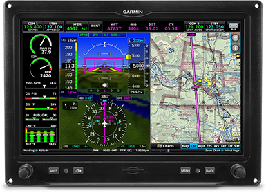
EASY-TO-READ SCREENS
These bright, high-resolution, large-format LCD displays are easy to read and easy to use — so you have a whole new perspective on situational awareness.
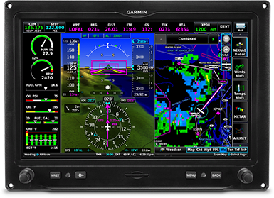
DISPLAY OPTIONS
The 10.6 inch display can be set up for either PFD, MFD or PFD/MFD functionality with an EIS strip. A single 7 inch display can accommodate either PFD and MFD functionality or MFD and EIS windows.
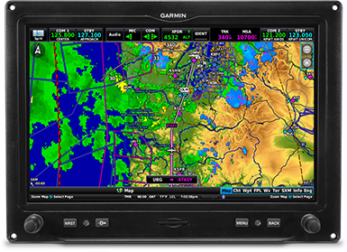
INSTALLATION OPTIONS
Pair up to three of the 10.6 inch or 7 inch portrait format displays — or install one now, and scale up your panel as your needs change.
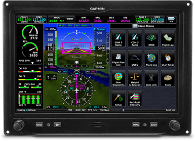
TOUCH AND KNOB CONTROL
Access display functions with easy touchscreen inputs — even while wearing gloves — or use the concentric knobs if that’s more your style.
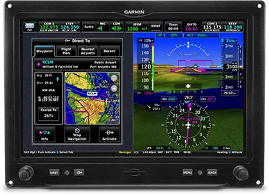
FLY DIRECT
Dedicated buttons on each display’s bezel allow you to quickly enter a direct course to an airport — or select from a menu of nearest airports or waypoints.
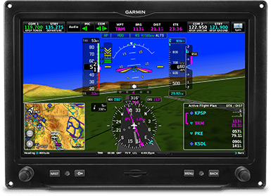
DIGITAL ADAHRS
GSU 25D ADAHRS provides highly accurate and reliable referencing of your aircraft attitude, heading, path vector and air data at a fraction of the space and weight of gyro-based instrument systems.
Critical flight information. Clearly in view.
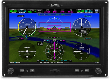
PRIMARY FLIGHT DATA
See attitude, airspeed, altitude, heading, vertical speed and more. Plus navigate with an HSI that accepts VOR/LOC and/or GPS course guidance, including both vertical and lateral course deviation, with your compatible navigator.
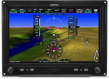
SYNTHETIC VISION TECHNOLOGY
Our SVX synthetic vision technology enhances situational awareness in all phases of flight by including 3D depictions of terrain, obstacles and airports.
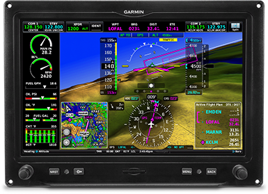
HIGHWAY IN THE SKY
Easily visualize your flight path, including en route legs, flight track, course intercepts and more, with our pathway boxes.
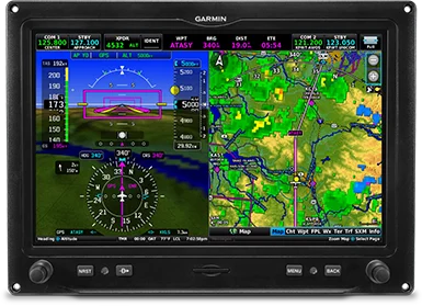
VERSATILE DISPLAY
Switch from full-screen PFD to split PFD/MFD with a touch — to put more valuable flight information directly in your field of view.
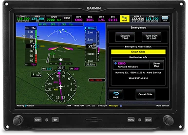
COMPATIBLE WITH SMART GLIDE™ TECHNOLOGY
When paired with the GTN™ Xi series navigator, G3X Touch supports Smart Glide engine-out navigation functionality. Once activated, Smart Glide recommends a nearby airport and creates a Direct-to route so you can land.
More situational awareness. For every flight.
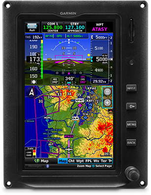
DYNAMIC TOPOGRAPHY
By referencing built-in terrain, mapping and obstacle databases, G3X Touch shows detailed surface features, cities, airports, SUAs and more on the dynamic map display.
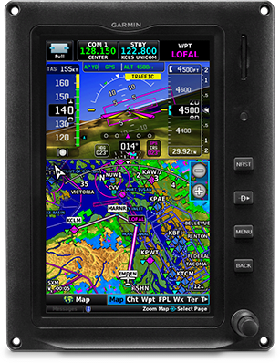
SIMPLE PAN AND ZOOM
Get all of your route information at your fingertips. Easily pan across the moving map by dragging your finger across the screen, or pinch to zoom to see more detail.
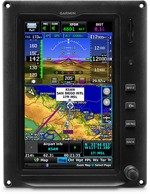
INTERACTIVE MAP
Touch anywhere on the map, and, using your current position, the display shows the distance, bearing and time to that location on the map — as well as its elevation and GPS coordinates.
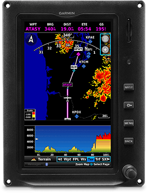
TERRAIN ALERTING
A built-in database depicts terrain and obstacles with color-coded 2D or profile displays — or both — while visual and audible alerts indicate when potential terrain conflicts loom ahead.
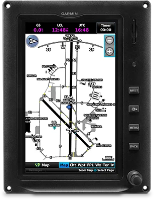
SAFETAXI® DATABASE
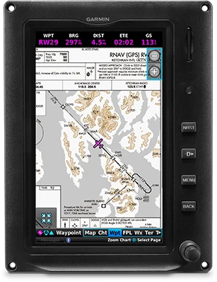
CHARTS IN CONTEXT
Our standard FliteCharts® procedure charts or optional Jeppesen® style ChartView™ plates — available with a subscription — provide georeferenced approaches and terminal procedures.
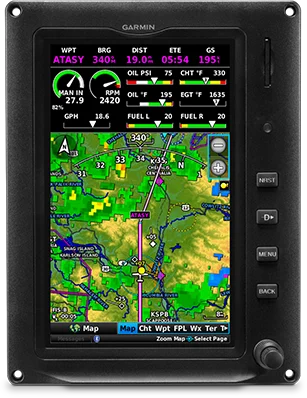
ADS-B “IN” AND “OUT”
G3X Touch can display ADS-B “In” weather and traffic information when connected with a GNX™ 375 navigator, GTX™ 345 transponder or GDL® 50R or GDL 52R receiver (each sold separately).
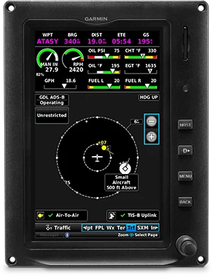
MONITOR TRAFFIC TARGETS
Pair G3X Touch with a compatible transponder (sold separately), and enjoy our proprietary TargetTrend™ and TerminalTraffic™ technologies to more intuitively monitor ADS-B traffic targets in the air and on the ground.
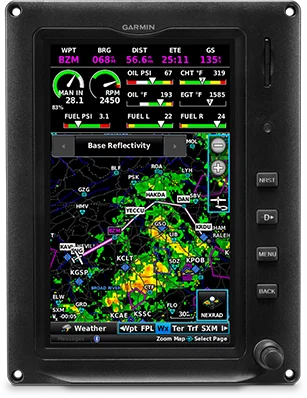
SIRIUSXM® WEATHER AND RADIO
Install a GDL 51R or GDL 52R SiriusXM receiver to display SiriusXM satellite weather coverage — as well as listen to audio entertainment.
Get powerful powerplant insight.
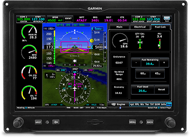
EIS INDICATIONS
Display primary engine indications with the addition of a GEA™ 24 module and appropriate sensors to show various engine, fuel and electrical gauges with easy-to-interpret color bands.
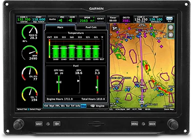
SUPPORT FOR POPULAR ENGINES
Engine sensor kits are available for most popular Lycoming or Continental 4- to 6-cylinder engines.
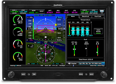
LEAN ASSIST MODE
Optimize fuel economy while maintaining high efficiency and performance of your engine with lean assist mode (when using optional GEA 24).
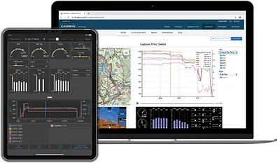
ENGINE DATA LOGGING
Download engine data to an SD™ card in the display, or wirelessly share to the Garmin Pilot™ app on your compatible smart device, and later upload it to the flyGarmin.com® website for analysis by your maintenance shop’s service team.
Integrated avionics control. At your fingertips.
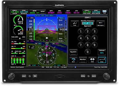
COMM RADIOS
Add up to two COMM radios (such as the panel-mounted GTR 225, GNC® 255, GNC 355 or GTN™ Xi series), and easily control active and standby COMM frequencies from the G3X Touch display.
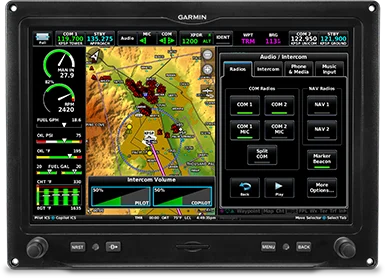
AUDIO PANEL
Control the advanced audio functions of the remote mount GMA™ 245R audio panel (PMA) right from your G3X Touch display.
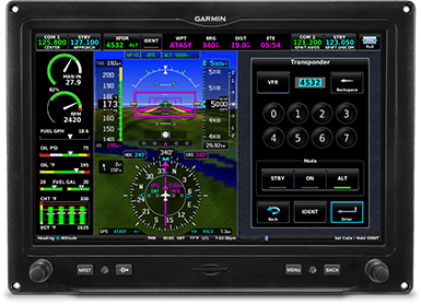
TRANSPONDER CONTROL
Easily enter squawk codes via your G3X Touch display to control a transponder, such as our GNX 375 or GTX 345.
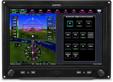
ADVANCED AUTOPILOT
Pair G3X Touch with the affordable GFC 500 autopilot4 for safety-enhancing features, such as overspeed and underspeed protection, a dedicated LVL button and Garmin ESP™ (Electronic Stability and Protection) corrective technology.
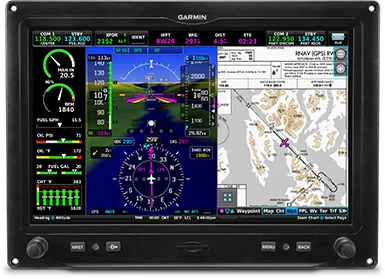
IFR APPROACH CAPABILITY
Add LPV/LNAV/ILS approach capabilities when you pair G3X Touch with select Garmin navigators (each sold separately), such as GTN 650Xi, GTN 750Xi, GNX 375, GNC 355 or GPS 175.
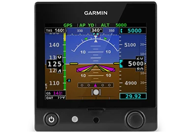
BACKUP ATTITUDE INSTRUMENT
Our optional GI 275 and G5 electronic flight instrument4 automatically syncs baro and bug settings. The G5 can drive your GFC 500 autopilot in the unlikely event of a display failure.
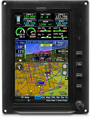
RELIABLE REVERSIONARY
In the unlikely event of a display failure, reversionary mode enables the remaining flight displays, in multiple display installations, to present all essential flight information — including EIS data when installed.
Sync your devices to streamline your flying.
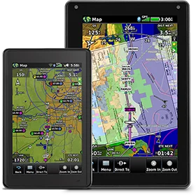
COMPATIBLE WITH CONNEXT TECHNOLOGY
Built-in Connext wireless connectivity makes true cockpit companions of your compatible mobile devices running the Garmin Pilot, FltPlan Go and ForeFlight Mobile apps — as well as aera® 660 and aera 760 aviation portables.
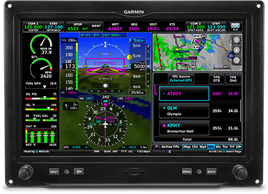
CREATE FLIGHT PLANS
Use your compatible mobile device or portable to create a flight plan in the comfort of your home, office or pilot lounge, and then transfer it to your G3X Touch with a tap or two — waypoints, airways, departures, arrivals and all.
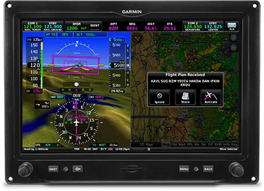
UPDATE EN ROUTE
Adding last minute or en route flight plan amendments from ATC — or due to weather — is easy. Simply make them on your compatible mobile device or Garmin portable, and sync again to conveniently and efficiently manage your cockpit.
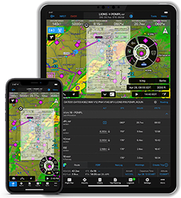
FLIGHT DATA STREAMING
Wirelessly stream GPS, attitude information and ADS-B traffic and weather data to your compatible portable or mobile device.
